Devil’s Causeway is Perfect Hike For Colorado Thrill Seekers
For thrill seekers wanting to experience a bit more than just a walk along a peaceful trail, the Devil's Causeway is the perfect hike.
Getting There

The Devil's Causeway is located in the Flat Tops Wilderness Area, between Meeker and Yampa. From I-70 take exit 157 for CO 131 Wolcott/Steamboat Springs and head to Yampa. From Yampa take County Road 7 for about six miles. It's then another 9 miles on Forest Service Road 900 until you get to the parking area on the north side of Stillwater Reservoir.
The Hike
The hike starts out easy enough as you walk along a lake and the side of a mountain lined with grassy meadows. As you near the top, the elevation gain changes dramatically, as you engage in a number of switchbacks leading to the summit. You will likely find yourself stopping to rest frequently as you gasp for air. Don't worry, the anticipation of reaching your destination provides plenty of inspiration.
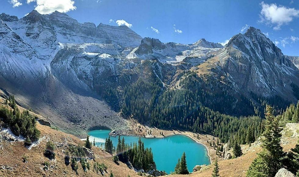
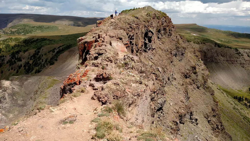
The payoff comes at the top where you enjoy incredible views from the causeway, a ridge four feet wide in some spots, that not everybody dares cross. It's not quite as scary as it sounds, but it does call for some sure footing and good balance. At times, using all fours is definitely the best option. Probably not recommended if you have a fear of heights.
After accomplishing the feat of crossing the causeway and getting some good photos, you'll probably want to stop for a snack, some water, and a little rest.
Heading back down the way you came is the shortest quickest way to get back to the trailhead. For the more adventurous, you can take the loop which means a 10-mile round trip hike.
You'll travel across the top of the causeway for at least a couple of miles before you start the actual descent. Along the top, you are completely exposed to the elements -- a dangerous position if a thunderstorm pops up.
On my hike, we did not see lightning but heard rolls of thunder, leading us to pick up our pace significantly to get to the lower landscape.
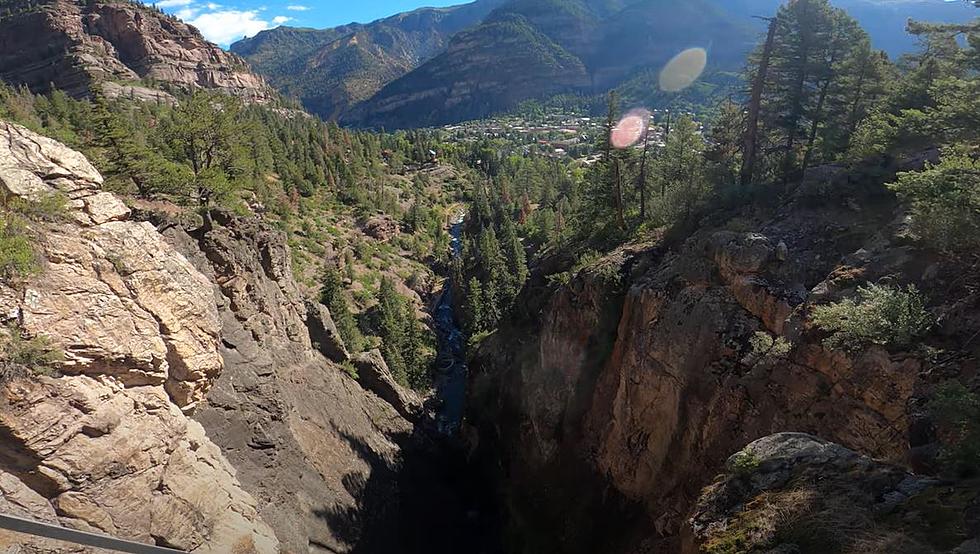
The trail beings to descend, taking you past lakes and through forests, with plenty of photo ops along the way. The trail remains well defined and easy to follow, as it was on the way up.
I would describe the hike as moderate in difficulty, and a notch or two above that if you decide to take the long way down.
Things to Know
- It's a six-mile round trip hike to the causeway.
- If you take the scenic route back down, it's going to be 10 miles round trip.
- Crossing the causeway is not something you would want to do with small children.
- Being at the top when a thunderstorm rolls through is not desirable so keep an eye on the weather.
- As with all hikes, bring plenty of water and snacks
Other Things to Do in The Area
More From ESPN Western Colorado